|
ATLAS
Book/Set of maps, with normalized format and presentation, that covers sistematically a geographical area and a chosen subject (usually, associated to an index). Difference in atlas are based on the subject, goal or kind of presentation. Among the several atlas, one can consider, for example, the world, the national, the regional and the local, or even the scholar and the historical ones.
CARTOGRAPHIC ACCURACY
Precision in the representation of information in the map. The accuracy depends, among other factors, on the map's scale and on the quality of the survey, also of the drawing and reproduction techniques used and visual acuity. On the contrary to what happens in the topographic maps, this feature is not essential in most thematic maps, although the absolute precision is not reached because graphic mistakes (technical or human) are innevitable.
CARTOGRAPHIC ASSOCIATION (degree of)
Relation between phenomena cartographically represented. The degree of association depends on the facts cartographically represented and on the criteria used in the comparison of maps.
CARTOGRAPHIC COMPLEXITY
Attribute of each map that shows the difficulty to apprehend the represented information. The visual complexity resulting from the map reading is closely related with the symbols and their distribution. Certain aspects of the cartographic complexity can be numerically assessed («objective» or measurable complexity) such as the contiguity of cartographic symbols or the kind of spatial distribution.
CARTOGRAPHIC PRODUCTION
1. In a broad sense it includes all steps in the map production process, from its conception to the presentation of the final document 2. It is usually used in a restricted sense, to refer to the most technical step of cartographic elaboration, meaning the drawing and map reproduction.
CARTOGRAPHIC REPRESENTATION
It refers to the inclusion of objects and phenomena in the map using cartographic symbols (see symbolization) to codify information included in a map.
CARTOGRAPHY
Traditionally, cartography includes, the set of methods and techniques that lead to the representation of the Earth or other planet's surface in maps, globes, block diagram, etc. The elaboration of these is made with observations made in the field, exploring varied documentations and also data provided by sensors that register earth and other planet's phenomena. Recently, Cartography has also included in its definition the theoretical studies on the use of those documents (A. C. I., 1973).
CLASS
1. Statistical class: set of numeric values gathered in a group, with a certain variation interval that is definied by the class limits, resulting from the subdivision of a variable 2. Spatial class or «region»: subdivision of the Earth surface in areas with similar features.
CLASS INTERVAL
It designates the features of the classes resulting from the application of class division processes. Class intervals can be constant, keeping similar amplitudes, in progression if they are progressively growing according to a certain rate of growth, or irregular if the amplitude of the several classes vary without predefined rules.
CLASS LIMIT
Numeric values that indicate the variation interval of a class: upper and lower limit.
COLOUR
1. Psychophyisiological property that features the sensation resulting from the visual perception of radiation coming from white lit surface (A. C. I., 1973). It is sometimes used as a synonym of hue 2. In Cartography, the use of colour (from inks) allows the reader to distinguish and express phenomena therefore, colour is considered a kind of cartographic symbol.
COMPUTER CARTOGRAPHY COMPUTER-ASSISTED CARTOGRAPHY
Branch of Cartography in charge of map production using informatically handled data.
CONTRAST
This feature, fundamental issue for cartographic legibility, is seldom defined one intuitively considers that this concept includes a set of perceived or measured differences (visual contrast or «objective»), resulting from the symbols' contrast and from their extension and their spatial distribution in the map.
DATA CLASSIFICATION
1. Grouping of a set of observations (qualitative or quantitative) according to «types», following conceptions that can be extremely diverse 2. It usually names the particular process of data classification where there is a partition of a set of numeric values (variable) that are gathered in a certain number of categories or classes. From a cartographic point of view, the main goal of this previous data handling results from the need to reduce the amount of information to be represented, making it easier to make and read the map.
DIAGRAM
Geometrical representation of the structure of the evolution of a phenomenon. There are several kinds of graphics with appropriate names, such as the histogram, the triangular diagram, the bar graphic, compass, etc.
ELEMENTS, MAP
They are the several parts that accompany and integrate the map. One can establish the difference between the fundamental elements (title, legend and scale), indispensable to map reading, and the accessories (grid, coordinates, orientation, etc.) also part of the map varying from map to map.
ENUMERATION UNIT
Limited surface used to support the gathering and storage of data and its thematic representation (see choropleth map) it generally corresponds to each element of the administrative division or of the grid.
GRAPH
Schematic representation of the topologic distance in a network that has several nodes or vertices (points that correspond to places) connected to arches its main goal is to show the structure of connections. A wide-known example is the representation of the underground network orienting its users.
GRAPHIC IMPLANTATION
Use of the representation surface, usually a sheet of paper. To graphically express the phenomena there are three types of symbols: points, lines and area.
GRID
1. Spatial reference system made up by straight lines perpendicularly intersected with uniform separation drawing squares (for example: UTM kilometric grid). This system enables to define the position of any point in the surface using rectangular co-ordinates in any projection system instead of referencing them through parallels and meridians 2. The use of a grid in thematic maps, as a spatial data base has advantages when compared to an administrative ground: homogenous features of the areas, easiness to store data and automatic map production, among others.
GROUND
1. Set of represented information that is used as a support to the subject of the thematic map, such as administrative limits, rivers or coast line. A map's ground can be made of elements significant to the subject studied or of simple spatial references 2. This concept appears, sometimes, referred in a larger sense, to express the surface on which a map or the cartographic symbols are set or their evolving surface. See base map.
HUE
1. Predominant wave length in a colour 2. Feature that establishes the difference between colours.
HYPSOMETRIC COLOURS
Sequence of spectral colours that are used to represent altitude classes. In this sequence, colour usually ranges from green (lower altitude) to brown-reddish (higher altitude), whereas the blue is reserved for the bathymetric representation.
INTERNATIONAL CARTOGRAPHIC ASSOCIATION (I. C. A.)
Internacional association, member of the International Geographical Union (I. G. U.), bringing together several national associations to promote Cartography and co-operation in this field.
INTERPOLATION
Operation used to find a set of values using other previously known values among which the first ones are placed. Interpolation is for example used to draw isolines.
ISOLINE
Line that connects points with similar calculated or estimated value in the representation of a continuos phenomenon. Isotherms, isohyetes, curve lines (or isarithms), isobars, isoptimals and isocrones are examples of isolines with an appropriate designation according to the represented phenomenon.
ISOPLETH
Isoline referring to the representation of phenomena whose values do not report to any particular point in the map. For example the number of inhabitants per square kilometre.
ISOPLETH MAP
c map representing phenomena using isopleths, whose drawing is achieved through interpolation, using a limited range of values, usually referred to a spatial base and to its administrative or geometric centre. See isoline map.
KEY MAP
See legend
LEGEND (KEY MAP)
Of the elements in the map made of the symbols used in the map, including a short explanation of their meaning. In a thematic map, it is possible to differentiate the explicit from the implicit legend: in this last one the symbols easily identified by the readers are considered (for example water streams or the coast line).
MAP COMPARISON
Operation in which two or more maps are confronted to each other in order to look for relations between the variable distribution and eventually to determin their degree of cartographic association. Visual comparisons are usually set apart from numeric ones.
MAP PROJECTION
Mathematical corresponding between the points of a referential ellipsoid, or part of it, and the points of a plan. To the cartographic representation of the Earth's surface, this is supposedly projected in the referential ellipsoid. Cartographic projections can be classified in several ways, according for example, to the projection surface (azimuth, conical, cylindrical) or to the position of its symmetry axis (normal, transverse, oblique) and its conservation properties (equivalent, conform and compensated or afilatic).
MAP USE
It is the process that allows to transform the information contained in the map to the mental image of reality it comprised three main activities: reading (or discrimination of what is represented), analysis (or identification of interesting structures) and interpretattion (or explanation of the observed cartographic structures) (P. C. MUEHRCKE, 1978, p. 8). This concept is usually used in a wider sense than map reading.
MAP, BASE
1. Map used to support the thematic map. The topographic and the chorographic maps are examples of these base maps 2. Set of sheets of the topographic map covering a country's surface that originate other maps. It is the case of the Portuguese topographic map sheets in the 1:25 000 scale, made by the Army Geographical Institute (Portugal). See ground.
MAP, CHOROGRAPHIC
Map, in the 1:100 000 scale or smaller that shows the general features of a region or group of regions, of a country or several countries. Its features in terms of contents and representation are very similar to those of the topographic maps.
MAP, CHOROPLETH
Thematic map representing numeric data, usually clustered in classes, referring to spatial units (administrative or other), whose contents are represented by blots, corresponding to the spatial basis, using sequences of symbols expressing class variation (or variation of the data, when these are represented) these maps are thus, used to represent non-continuos phenomena. The Greek words «Choros» and «plethos» correspond to place and magnitude or importance, respectively.
MAP, DOT
Thematic map representing a quantitative phenomenon using dots with a constant value (or dots with unit value) and of equal size evenly scattered or not (point or area graphic representation).
MAP, FLOW
Thematic map using lines with variable width (generally related to numeric values or value classes) features of linear and moving phenomena (examples: number of vehicles circulating in roads foreign trade).
MAP, HYPSOMETRIC
Map representing altitude classes through conventional chromatic sequences known as hypsometric colours.
MAP, ISOLINE
Thematic map representing spatially continuos phenomena using isolines. See isopleth map.
MAP, PROPORTIONAL CIRCLES
Thematic map representing a quantitative phenomenon using circles with a surface proportional to the data.
MAP, SKETCH
Thematic map, essentially conceived for explanatory goals, that represents in a very general way, a set of geographic phenomena, giving relevance to their spatial relations. The sketch map is a more general variant of the «croquis» or regional outline.
MAP, STATISTICAL
Expression widely used to designate any given thematic map (it is not in use any more) representing numeric values connected to administrative units (A.C.I., 1973). This concept covered several kinds of thematic maps, nowadays known by their specific names.
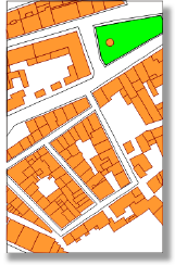
MAP, THEMATIC
Map representing on a more or less simplified base/ground (topographic map or information obtained in this map or in others), phenomena able to be located and of any qualitative or quantitative nature. The use of this expression conventionally excludes topographic maps (A.C.I., 1973).
MAP, TOPOGRAPHIC
Map with the aim to represent altitude and surface features of the Earth's surface, as faithfully as it is allowed by its scale (A.C.I., 1973). Maps can also be defined by the scale, usually settled between 1:10 000 and 1:50 000 (or 1:100 000).
MAP CHART
Graphic representation of part or total of Earth's or Universe's surface, and representation of concrete or abstract phenomena here located. In Portuguese, the word map is preferable to the word chart.
MAPA-MUNDI
Map representing the entire Earth's surface (or other planet's surface) separating two different hemispheres represented by circles. See planisphere.
MENTAL IMAGE
It is a set of conceptual and perceived information, stored in the long-term memory, resulting from the direct experience of the senses existing in the presence of observed objects.This concept is often confused with the idea of mental representation. This last one refers to the recall of objects in their absence, or if they are present, complement its perceptive knowledge using absent elements.
MUNSELL COLOUR SYSTEM
System of colour identification based on the way colours are observed this designation results from its creator (A. H. MUNSELL). In this system, each psychological dimension of colour is subdivided in intervals that are similar from the visual point of view. Today there are more than 1500 identified species.
pattern ARRANGEMENT
Arrangement of graphic elements that form the regular area patterns. If these are made of dots, the arrangement can follow a square or triangular shape, forming imaginary lines that join dots (lines or visual axes) with 90º or 60º angles in a square like arrangement there are two visual axes and along them the eyes tend to organise the dots whereas they are three in a triangular disposition.
pattern TEXTURE
Spacing of the graphic elements of a pattern (points, lines or others), expressed in the number of those elements repeated per length unit (it is usually used the linear inch). In a regular point pattern, for example, the spacing is measured from the centre of the points. A fine texture presents a high number of lines, meaning lines made of points or elements repeated per inch (usually between 60 and 100 or more) a coarser texture means a small number of lines (generally lower than 40) (H. W. CASTNER e A. H. ROBINSON, 1969).
PLANISPHERE
Map representing the entire Earth's surface (or of other planet) not separating the hemispheres. See mapa-mundi.
PRINTING, MAP
Reproduction of the map using printing techniques. This means using colourful substances (inks) on a printing surface. «Offset» printing is one of the possible techniques.
PSYCHOLOGICAL DIMENSIONS OF COLOURS
They are the three features that define colour in any system to identify colours based on human reactions, like the MUNSELL system (A. H. ROBINSON, 1967 A. ROBINSON et al., 1978). These dimensions are usually referred in this system as colour or hue, croma (concept equivalent to intensity) and «value».
QUALITATIVE REPRESENTATION
Cartographic representation of non-quantitative features of phenomena.
QUANTITATIVE REPRESENTATION
Cartographic representation of measurable features of phenomena.
SCALE
Mathematical reason/relation between a distance in the map and the corresponding real distance. The scale can be numeric or graphic. In the first case, the fraction's numerator (distance in the map) corresponds to 1 and the denominator the real distance, in the same measure unit to express it, it is usually used one of the following notations: 1/50 000 or 1:50 000. The second notation is preferable to the first one.
SEMIOTICS
Study of graphic symbols, their features and relations with the information expressed. In his book «Sémiologie graphique» (l.a ed., 1967), J. BERTIN defined the key-concepts, still being the most remarkable work on this subject.
SHADING SEQUENCES PROGRESSION
Orderly set of area symbols, usually in a restricted number, varying in the entire or part of the value range, or even, secondarily in other issues with the aim of representing classes.
SUBJECT
Group of facts that are the central subject represented in a map, usually mentioned in the title. In a thematic map, it is possible to differentiate the featured subject from the ground supporting this subject.
SYMBOL
Graphic representation of an object or phenomenon evoking it in a simplified or schematic way with more or less accurate representation suggesting the area occupied. Symbol is different from graphic element because this last refers to the unitary constituents of the first. Several categories of cartographic symbols are considered: points, lines or areas (according to their graphic implantation), figurative or abstract (evoking the reality), proportional, geometrical, etc. (according to their features). In Cartography it is not usual to use the word sign as synonym or approximate meaning the exception is conventional sign that designates certain symbols in topographic maps or similar that could only be represented with an exaggerated dimension in relation to the map's scale.
SYMBOL SCREEN AREA PATERN
Area symbol made up of graphic elements (points, lines or others) regularly repeated giving a uniform appearance.
SYMBOL, ABSTRACT
Symbol whose graphic shape holds no relation with the appearance of the pictured object, not evoking it, on the contrary to the pictorial symbol. Geometrical symbols are very often abstract.
SYMBOL, AREA
Symbol with uniform appearance (colour or area pattern) representing in a map the area where a phenomenon takes place or where it shows certain features.
SYMBOL, DOT
1. Graphic element of minimal dimension that allows to represent objects whose real size is not susceptible of graphic representation respecting the map's scale 2. In the thematic maps, point symbols are usually geometrical figures that can achieve considerable surfaces when representing numeric data (for example proportional circles map).
SYMBOL, GEOMETRIC
1. Point symbol corresponding to an elementary geometrical figure (triangle, square, rectangle, circle or semi-circle) 2. Area symbol made of graphic elements (points, lines or others) regularly repeated area symbol/screen pattern.
SYMBOL, LINE
1. Symbol whose width is negligible in comparison to the length. It is used to represent objects or phenomena following a dominant direction or to limit informations. Isoline is a linear symbol 2. In the thematic maps linear symbols may occur whose width represents the numeric variation of the data (for example: flows of cars or goods). See flow map.
SYMBOL, PICTORIAL
Symbol, usually stylised, evoking people, animals, objects or ideas.
SYMBOL, PROPORTIONAL
Symbol, very often point symbol, whose size varies with the numeric importance of the represented phenomenon. See, for example, proportional circles map.
SYMBOLIZATION
It is reserved for the choice of symbols to represent the theme (or themes) in thematic maps in this sense it is a more restricted term than cartographic representation that includes all representation in the map.
SYSTEM OF COLOUR IDENTIFICATION
Set of rules describing and specifying the colours, in numeric terms, without ambiguity. There are several systems, some of them based on the analysis of physical features of light and others based on the human reactions to those features. Among the first, there is the CIE system (Commission Internationale de l'Éclairage) among the last, the MUNSELL system is one of the most widely known and used. In these systems, each colour is defined according to three physical features (different from the perceived ones) or psychological (see psychological dimensions of colour).
TITLE
Set of written information briefly identifying the map. It includes the theme and, in some cases, the area covered or other information.
VALUE
Feeling of clear or dark, referring to ordered series of grey. These are known as grey scales. It corresponds to the psychophysics measure of the black/white relation. This parameter, describing the perceived blackness, is assessed from 0 (black) to a maxim limit (white) that varies according to the identification system (being 10 in the MUNSELL system).
|